Back in the middle of winter (in New Zealand) I decided that I needed to get away to somewhere warmer for a bit, just to make the winter seem not as endless. (About a decade ago, I had a client in Europe that would often have me come to Europe in the Northern Hemisphere summer, and in hindsight spending June/July in the Northern Hemisphere does a lot to make the Southern Hemisphere look much less long...)
Since (a) Brisbane (Queensland, Australia) is relatively easy to reach from here (two relatively short flights), (b) I'd really enjoyed my last trip to Brisbane, (c) I'd meant to go to the Sunshine Coast (north of Brisbane) during my last trip, but it didn't work logistically, (d) particularly the Sunshine Coast should be far enough north to get warmer weather and (e) it turned out I had enough frequent flyer points to get to and from Brisbane, I decided to go to Brisbane in July 2012.
Between wanting to avoid the school holidays (both in New Zealand and Queensland, Australia), and wanting to be back in time for the Film Festival -- starting in the last week of July -- there was only a week long period in which I could travel. So I was in Queensland for the third week of July. I spent the couple of days in Brisbane, and then rented a car and drove north.
Brisbane
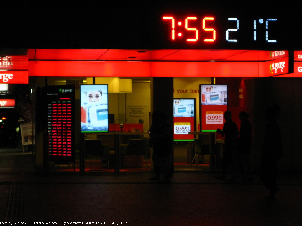
I stayed the first two nights in The Manor Apartment Hotel, right on Queen St in Central Brisbane. I'd stayed there in 2011, after Linux.Conf.Au, soon after the January 2011 floods in Brisbane. Once again it provided an ideal base to explore the central city. Photos from Brisbane. I knew the week was going to work out well when it was still 21C at 19:55 on the day I arrived (it was about 8C in Wellington when I left!).
This time mostly avoided public transport (in favour of walking) until Monday (my last full day with accommodation in Brisbane). On Saturday and Sunday I covered South Bank, the West End, and central Brisbane on foot. Including walking through Roma Parklands on Sunday morning in time to catch a set of friends staging an clue-based walk around the Parklands for a couple, with one of them set to propose at the end (hopefully the other -- who wasn't in on the full plan -- said "yes" after all that effort!).
On Sunday evening I discovered that there was a Brisbane Greeters free walking tour of public art on Monday morning (apparently the Brisbane Greeters were newly started in 2012; but there are Greeters volunteer organisations in many cities around the world). Our group consisted of three German tourists (a couple in their 20s and a student), and me. The tour was led by Carol, our Greeter. Since part of the tour was on Kangaroo Point (across the river from the CBD), we all needed TransLink Go Cards for the river crossing -- so the second stop of our tour was at a retailer that sold Go cards. (I then used the card both for that crossing, and also for a later ferry-based trip downstream and back again, as well as to get to the Avis office to pick up the rental car on Tuesday. I was able to get the balance refunded at Fortitude Valley station after dropping off the rental card, since I'd only used cash when paying for/topping up the card; any use of a credit card means that they have to mail the refund to an Australian address, a month later, so tourists might as well give up.)
The Brisbane Greeters art tour itself was excellent, taking me past both art that I'd seen (but adding more explanations) and also taking me past art in public that I had not come across (including at the top of Kangaroo Point). Some of them items on the tour were hidden on side streets/alleys, and were things that one would not necessarily discover without knowing to look. Carol explained that recent government rules require any organisation building in the CBD to also commission a work of art as well as the building construction; it seemed an excellent way to get more art in the central city. The Wintergarden Plaza, which was nearly closed last time I was in Brisbane (just a couple of places open among the construction), had a huge work of art covering the entire face of the building over Queen Street (although not visible from directly below because of the veranda -- you need to look from across the mall); apparently it also has a light show at night, but I didn't see that.
In addition the tour proved an ideal way to gather a like-minded group of people to explore the city when one is travelling by oneself. I'll definitely have to keep an eye out for Greeters in other cities I visit.
Sunshine Coast
On Tuesday I picked up my rental car from Avis in Fortitude Valley -- one stop closer to the airport on most train lines. Fortitude Valley is walking distance from the CBD, given some time, and that was my original plan -- but between the walking of the Greeters art tour on Monday and the "forced" purchase of a Go card with credit left, I decided just to take the train. Which had the advantage that I could take my luggage with me, rather than having to deal with trying to drive back to central Brisbane and find somewhere to park to collect my bags.
The plan, as much as I had one, was to drive up the Sunshine Coast and take five days to get some sunshine and see some of the sights. With some directions from Avis I headed towards the M1 and the Sunshine Coast (although there was one critical turnoff -- left just before the bridge -- which didn't seem signposted until it was almost too late to get into the "left turn only, only lane to turn left" lane in time).
Nambour
My first stop was Nambour, an inland "rural support" town a bit over an hour from Brisbane. It turns out it is actually the local government centre for much of the region that I visited during the week; but I didn't know that until I checked Wikipedia today.
I stopped in Nambour partly due to mishearing a suggestion the day before and partly because I needed a stop. Nambour is a public transport hub for the Sunshine Coast, but didn't seem particularly welcoming to tourists (no obvious information centre, and I saw only two motels). It did, however, have a lovely "Gluten Free" health cafe called "Husk & Honey", where I had an afternoon coffee (if I'd arrived earlier I would definitely have had lunch there; sadly they weren't open for dinner, or I might have decided to stay). Without much else to keep me in Nambour I decided to carry on to the Noosa region which is the main "place to see on the Sunshine Coast" that people always mention.
Noosa Region
The Noosa region (photos of Noosa) reminds me of the phrase "you're in a maze of twisty roads, all alike". There is no single "Noosa" place that you can visit; instead it is a set of slightly separated built up areas, mostly with names that include "Noosa" in them (but not all). The roads between them are connected by approximately a million roundabouts, all of them with signs just before the roundabout with a few place names in some directions and the vague "all other destinations" label against the remaining direction. Unless you pay very close attention to the place names, and check carefully at every roundabout, you can easily end up taking a very "random walk"; even by the third day I was there, I still ended up taking more random journeys than I had intended, despite having a map and a couple of days driving around the area. The lack of any obvious street names on the major roads (even though they do have names on the map) left me wondering if I should be looking to "drop items" at roundabouts so I could tell I'd been there before...
However it is definitely worth persisting with travelling around Noosa. There are some very nice cafes and restaurants there, particularly on Hastings St (the up-market, expensive, street next to Main Beach) but also elsewhere. Organika, a cafe and organic food store was a particularly good find -- at some length I even managed to find it a second time so I could have lunch there! Noosa National Park is also well worth visiting, both around the coast and also the inland rain forest walks. (Many of my photos from Noosa are from the National Park.)
Accommodation is pretty expensive near the ritzy Hastings St/Main Beach area, even in the middle of winter, but it is very pretty. Other nearby areas (particularly Tewantin) are fairly obviously lower income areas than the "house and yacht" of properties around Noosa Sound or Noosa Waters; that same pattern seemed to repeat itself further down the Sunshine Coast (towards Brisbane) as I saw on days later in the week.
After two nights in Noosa I decided against trying to head further north (with only three nights left before my flights back; and later decided against trying to rush down to see Byron Bay, past Brisbane and the Gold Coast, for the same reason of not wanting to spend whole days driving). Heading south again (towards Brisbane) my plan was to stay at a couple of places on the way back.
Maroochydore and Mooloolaba
My first stop was Maroochydore, about 20 minutes drive south of the Noosa region. I nearly did not stay there, because the "town centre" labelled part of Maroochydore seems to be really struggling, especially the "Big Top" mall (which is literally half empty), and there was minimal tourist information (a street map outside the Big Top mall). However after giving up on Maroochydore and heading south intending to try the next town south, I did find an actual information centre (well away from the town centre sign... as the road went out by the beach again), with a very helpful man who found me a nicely priced motel room for the night... back in Maroochydore. He also gave me suggestions on where to find better food, shopping, etc, just down the road. So I ended up staying in Maroochydore.
Mooloolaba (photos from Mooloolaba), a few minutes south of Maroochydore is very clearly the moneyed tourist destination of the area. It has a fairly large beachside shopping precinct, with a good selection of cafes, as well as some nice walks along the beach and nearby; I went there for coffee and walks twice. But I actually had a nice dinner at a South African themed restaurant in Maroochydore itself, where they understood both Gluten Free and Dairy Free (Gluten Free seems to be pretty well recognised in Australia now, but Dairy Free does not seem to have much traction -- since I wanted both, eating became progressively more of a challenge the further I got into "budget" travel locations).
Caloundra and the Glass House Mountains
After that night I did seriously consider driving to Byron Bay (about three hours away; two hours south of Brisbane; tourist information) since it was another of those Named Destinations (tm) that I had been wanting to see (the producer of the Risky Business podcast is based there, and several friends have been there and really enjoyed it. But in the end the weather and a plan of minimising driving time favoured staying on the Sunshine Coast. So I decided to head to the "next town south", making my way slowly back to Brisbane. And after realising that I had had enough "beach" time and what I really wanted was some mountains and bush, my plan for the day was to head to the Glass Mountains National Park, inland from Caloundra.
Caloundra is a seaside town about an hour north of Brisbane (and about 15 minutes south of Mooloolaba). After a few false starts I eventually found the town centre information centre (the main information centre turned out to be between the road I'd come in on -- Nicklin Way -- and the M1, away from Caloundra; but very confusingly signposted for those arriving after coming down on the Sunshine Highway). The information centre pointed me at a reasonable motel nearby, at a reasonable price, which sorted out accommodation. A brief walk around Caloundra showed me I was back into "commuting distance from Brisbane" satellite town distance, rather than tourist driven beachside resort. So I found an inexpensive lunch, and then headed for the Glass House Mountains National Park.
The Glass House Mountains (photos from around the Glass House Mountains) are very striking peaks on the almost flat Australia landscape -- they can be seen from quite some distance away both north and south, and are each distinctively shaped. They are all fairly small (mostly a couple of hundred metres above sea level; by contrast Mt Kaukau near my house is nearly 450 metres above sea level, and does not seem particularly high, given I walk up it several times a year on a whim...).
At a suggestion of a man in the Glass House Mountains Visitor Centre, I climbed Mt Ngungun (pronounced "gun-gun", the "N" is silent) both for the exercise and also to get a better view of the area. The first two thirds of the track up is very gentle, and suitable for a children's buggy; the last third definitely earns the advice at the bottom that it is a steep climb! The last third of the climb is basically straight up a steep boulder pile, in two sections, and slowed most people down. The view from the top is definitely worth the effort of climbing up.
Bribie Is
On the day that I flew out, I asked the Caloundra information centre for suggestions on where to stay for my final night, between Caloundra and Brisbane. Since it was only an hour from central Brisbane, there weren't that many "touristy" options left before reaching Brisbane. The most promising suggestion was Bribie Is.
Bribie Island (photos from Bribie Is) is a small island connected to mainland Australia by a bridge. About half the island is a National Park, mostly only explorable by four wheel drive; the rest is a series of small "beach" towns. There is only one road out to Bribie Island, and while it is reasonably well signposted from the main highway (Bruce Highway, the M1), I struggled to find it: I decided for variety to travel down Steve Irwin Highway which runs inland by the Glass House Mountains National Park (and through Beerwah, etc), and by the time I turned towards the coast, it turned out that I was too far south, but there were no signs to indicate if I was south or north or where I needed to be, so I went south for a while before turning around and heading north again. (The highway is named for Steve Irwin (the "Crocodile Hunter") since it is the road to Australia Zoo which he founded.)
Since the Bribie Island National Park takes more than half the island, I wanted to see a little of it. There is a small section near the housing that has some short walking tracks. Despite having a tourist map showing where it was supposed to be, and an indication of where to start (near the Art Centre), it took me quite a while to locate the entrance: there instructions for where to start were unnecessarily vague, the map of walking tracks seemed to be misaligned with the roads, and one entrance was hidden beyond a retreat and the other was between somewhat overgrown trees with just a "National Park" sign (no other words) to indicate what it was. (With hindsight, the trick is to to go the Art Centre, park in the carpark, walk to the south-west corner of the carpark, through the Art Centre gardens walking area, and then you should end up in the National Park walking area -- it is basically sandy, barely signposted, tracks. But worth the effort.)
Return
My final day was taken up with breakfast/coffee, driving back to Brisbane (which took over an hour and a half to get back to the Avis office by the time I hit the Brisbane traffic; if I'd been reading the signs more carefully, and known Brisbane better, I could have shortcut some of that trip as I ended up going into central Brisbane and then back out to Fortitude Valley).
I definitely felt I had achieved the purpose of the trip: a woman in the Caloundra information centre had said that it had been "relatively cool" that week, and I think she was somewhat surprised when I pointed out that it had been 20C or higher every day during the middle of winter -- a vast improvement on the 8-10C highs in Wellington during winter. So I intend to do something similar in 2013; perhaps Byron Bay this time?